
Cala Mariolu is often called one of the most beautiful coves in the Gulf of Orosei, and it’s also one of the more logistically involved to visit — a regulated sea landing, three possible departure ports, and a land route demanding enough to be a different undertaking from a normal beach hike. This guide focuses on getting there and what to expect.
What Cala Mariolu Is Actually Like
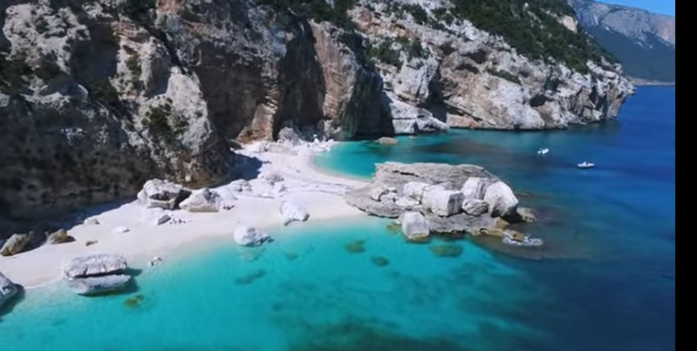
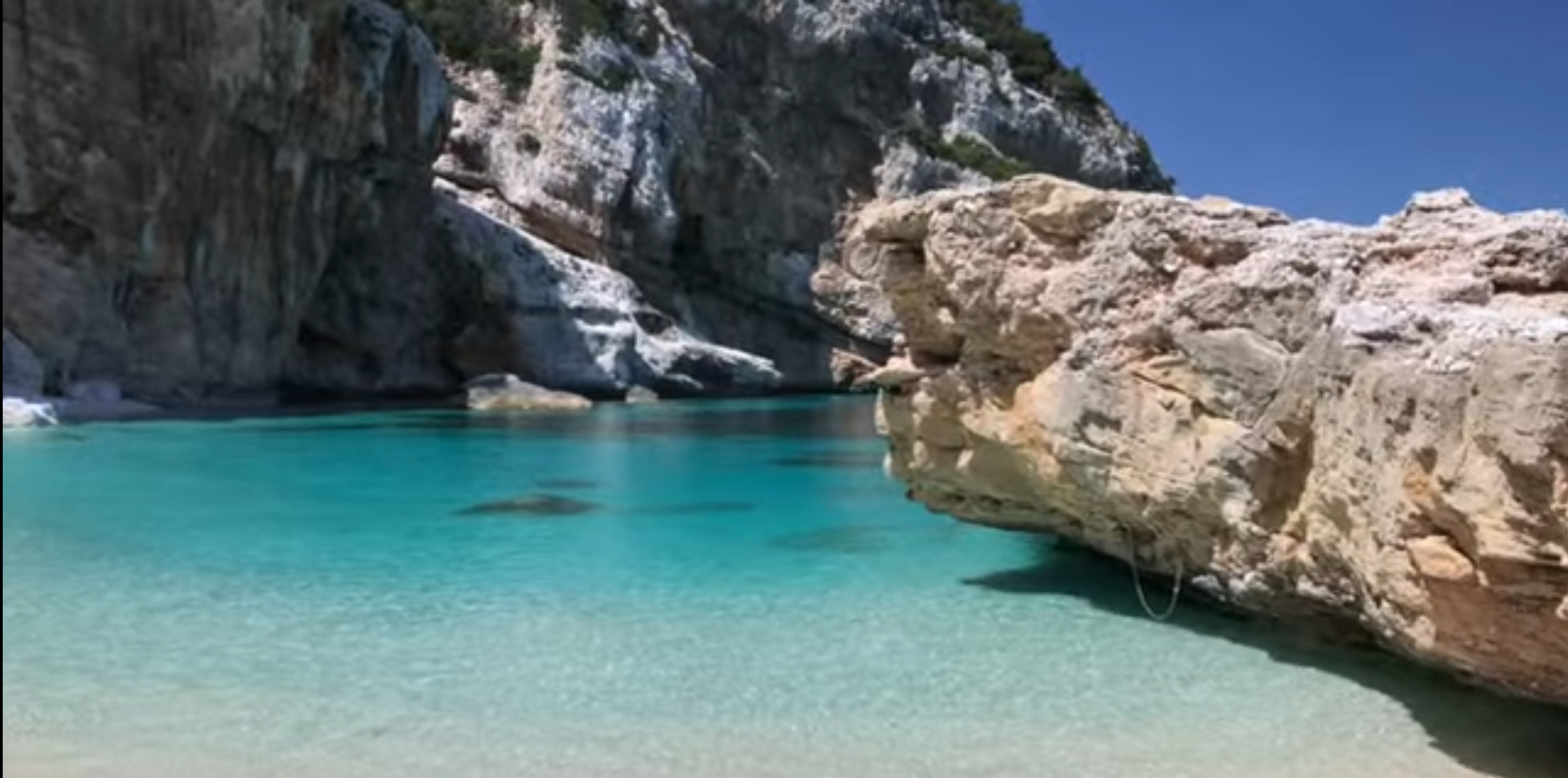
Cala Mariolu sits on the Baunei coast, roughly midway between Cala Gonone and Capo Monte Santo, backed by a striking white limestone cliff and a pine forest above the beach. It’s compact — around 300 meters long, split into two sections by a large rock that also serves as a mooring point for tourist boats. What sets it apart is the combination of pale, rounded pebbles and water that shifts through a genuinely unusual range of blues, even close to shore.
Ispuligidenie: The Traditional Name
Before it was Cala Mariolu, this cove was known locally as Ispuligidenie — a name that, according to the official Baunei tourism authority, predates “Cala Mariolu” by generations. It comes from Baunese Sardinian and translates roughly to “snow fleas,” describing the beach’s small, pale, wave-smoothed pebbles. “Cala Mariolu” arrived later, brought by fishermen from Ponza who settled around Cala Gonone and Arbatax in the early twentieth century; “mariuolo” meant “thief” in their Neapolitan-derived dialect, a nickname for the Mediterranean monk seals once common here, seen as “stealing” fish from nets. Both names are still used today.
Beach Composition and the Pale Pebbles
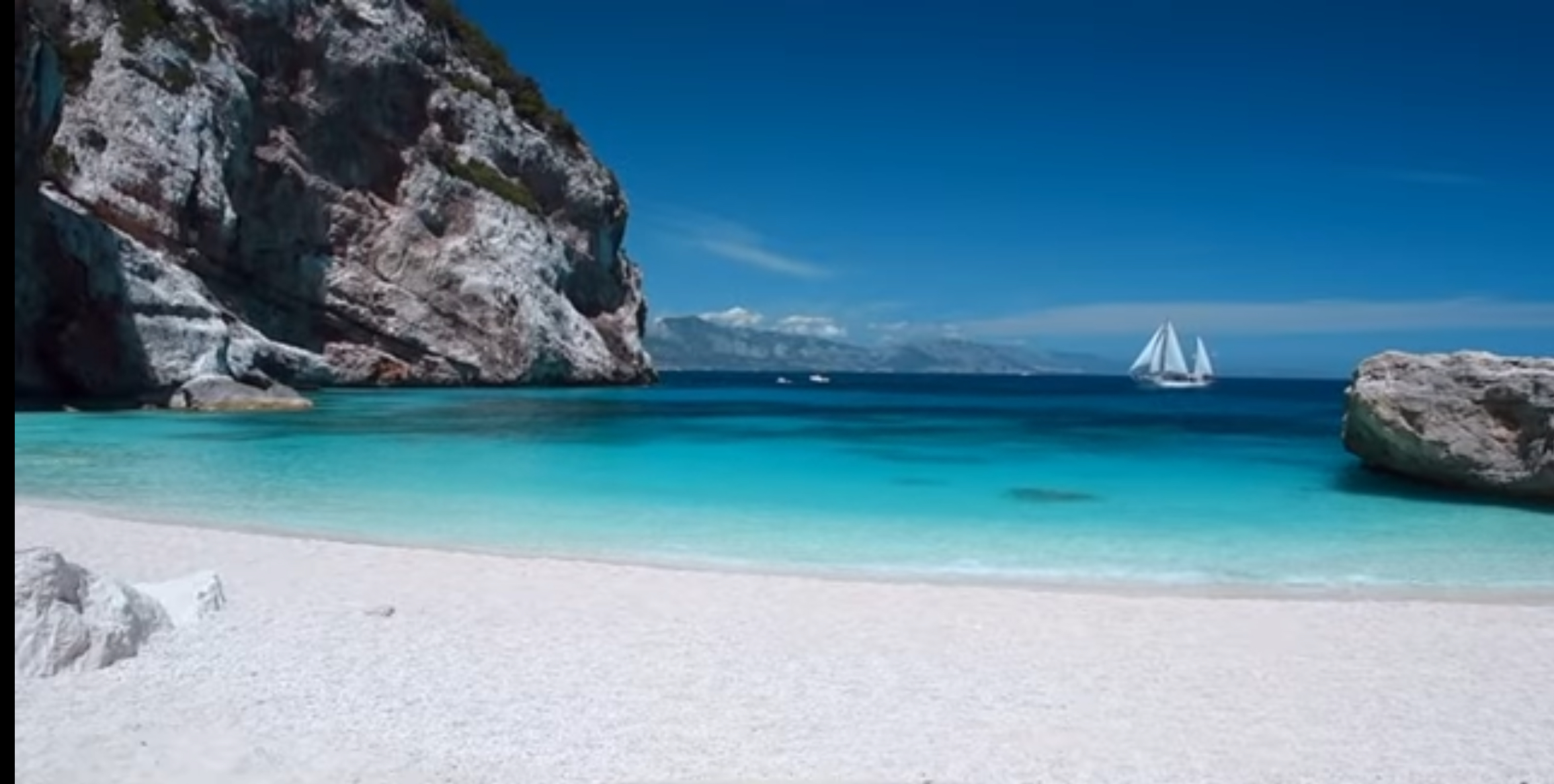
The beach itself is entirely pebble rather than sand — smooth, rounded, and pale enough to be often described as looking like snow or frost from a distance, exactly what gave the cove its original name. This isn’t a beach for bare feet if you’re sensitive to uneven ground; water shoes make a real difference here, covered further below.
Water Color, Clarity, and Swimming Conditions
The water at Cala Mariolu is consistently described as some of the clearest and most vividly colored in the Gulf of Orosei, shifting from pale turquoise near shore to deep blue further out, with visibility that regularly reaches well below the surface on calm days. It’s a genuinely good swimming beach, though conditions can change with wind and swell, and the gulf’s open, east-facing exposure means easterly winds can affect swimming comfort and, as covered below, whether boats can land at all. Depth and sea conditions vary along the shoreline, so don’t assume a uniform, gently sloping bottom — children should be closely supervised at all times.
Boat Access from Santa Maria Navarrese
Santa Maria Navarrese, covered in our Santa Maria Navarrese guide, sits closer to Cala Mariolu than Cala Gonone does, making it a natural southern departure point. Boat excursions from here commonly combine Cala Mariolu with Cala Goloritzè and Pedra Longa on the same run, since all three sit along a similar stretch of the Baunei coast.
Boat Access from Cala Gonone and Arbatax
Cala Gonone, the central hub, has long been the most established departure point for Gulf of Orosei boat services. Travel time to Cala Mariolu varies by vessel, route, stops, and sea conditions — confirm current crossing times with your operator rather than assuming a fixed duration. Arbatax, further south, is another established departure point, often paired with Pedra Longa. Your departure point shapes which other coves fit into the same day: from Santa Maria Navarrese or Arbatax, Cala Mariolu pairs naturally with Cala Goloritzè and Pedra Longa; from Cala Gonone, it more commonly pairs with Cala Luna.
Some links on this page are affiliate links. If you book through them, SardiniaSardegna may earn a commission at no extra cost to you.
A Shorter Boat Excursion from Arbatax
If you’re staying in Arbatax or Tortolì and prefer a shorter outing, this guided RIB excursion follows the Baunei coast toward Cala Mariolu and Cala Goloritzè. The advertised experience lasts approximately three hours and emphasizes coastal scenery, swimming opportunities and brief stops. It is not the same as spending several hours on Cala Mariolu beach. Check the current itinerary to understand exactly where the boat stops and whether landing is included.
Scheduled Motorboats vs. Smaller Guided Excursions
As with the rest of the Gulf of Orosei, larger scheduled motorboats run fixed routes and timetables at the lower end of the price range, typically carrying more passengers. Smaller guided RIB excursions cost more but move at a more flexible pace, often combining Cala Mariolu with a broader stretch of coastline. Landing duration depends on current municipal rules and your operator’s assigned schedule — confirm the permitted stay with your operator or the current official booking system rather than assuming a fixed window.
Explore Cala Mariolu on a Full-Day Boat Tour
For visitors departing from Santa Maria Navarrese, this guided dinghy excursion explores the Baunei coastline, with an advertised itinerary including Cala Mariolu, Cala Biriala, Cala Goloritzè and Grotta del Fico. It is a longer outing than the shorter Arbatax sightseeing excursion, with more time allocated to exploring the coast. Confirm the current beach stops, cave admission costs, landing arrangements and weather policy before booking.
Private or Self-Driven Dinghy Access
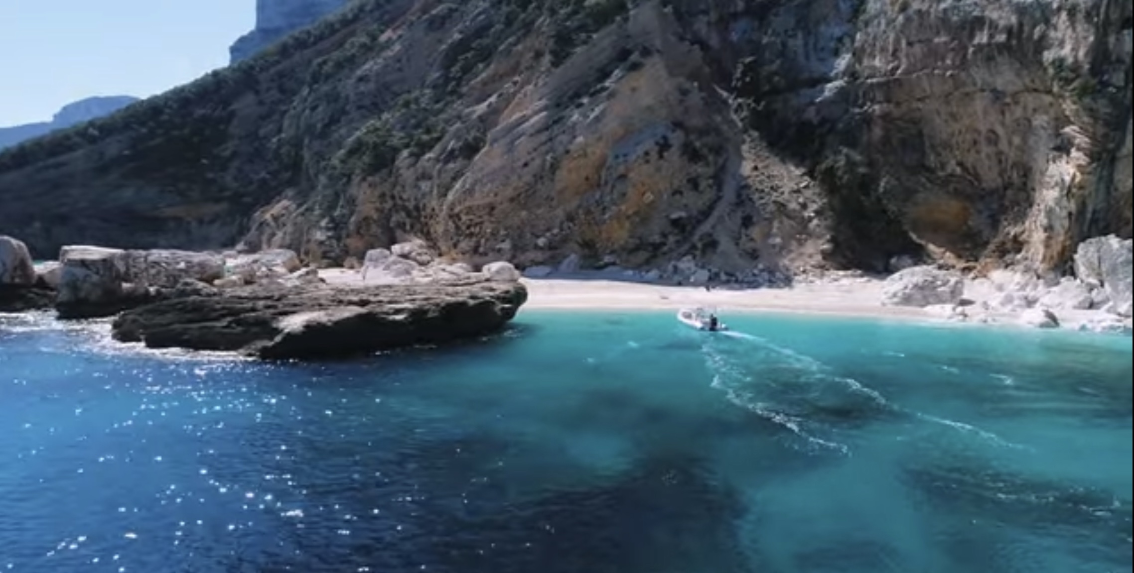
Renting a small boat or dinghy and reaching Cala Mariolu independently is possible, but it puts the full weight of navigation, weather judgment, and the booking process below on you. If you’re at the helm of a private or rental boat, you’re responsible for using the official sea-landing system yourself — this suits experienced boaters, and is a poor choice for anyone without real experience reading sea conditions on this coast. A guided excursion is the safer, more relaxed choice for most visitors.
The Current Regulated Sea-Landing System
Sea access to several beaches along the Baunei coast within the Gulf of Orosei — including Cala Mariolu — is currently regulated, with a booking system for landing by sea. For the 2026 season, the official booking platform lists the regulated period as May 1 through October 20, 2026, with a capacity of 700 sea-landing places at Cala Mariolu, and a landing fee of €2 for a single cove by sea or €3 for a multi-cove itinerary by sea in one day. This ticket applies specifically to sea arrivals — it does not apply to permitted land access via the hiking route described below.
Treat these 2026 figures as a snapshot, not a permanent rule. Capacity, fees, and the regulated date range are all things to verify directly with the Comune di Baunei’s official tourism site or the current Heart of Sardinia booking platform before you travel, rather than relying on any figure printed here.
Do Operator Passengers Need to Book Separately?
How you book depends on how you’re arriving, not simply on whether your boat has a skipper. If you’re at the helm of a private or rental boat, use the official sea-landing booking page, select Cala Mariolu specifically, and enter any operator code supplied by the rental company. If you’re traveling with a ferry, an NCC (private hire) service, or a skippered dinghy, ask the operator first — the booking or fee may already be handled on your behalf, but this isn’t guaranteed across every operator. Don’t assume either way; confirm directly with whoever you’re booking through.
Why You Must Verify Rules Before Departure
According to the current official booking platform, self-booked sea-landing slots typically open the same day at 07:00, with additional quota sometimes released later in the morning if earlier slots have sold out. This system continues to be refined season to season — capacity limits, fees, the regulated date range, and even which coves are included can shift year to year or mid-season. Confirm current rules shortly before you travel, and again the day before if possible, rather than relying on anything printed in advance, including this article.
What Happens When Weather Prevents Landing
The Gulf of Orosei is exposed from the east, and wind from the northeast or east can make landing at Cala Mariolu difficult or impossible, particularly for smaller craft. When conditions don’t allow a safe landing, operators typically adjust the itinerary — an offshore swim stop instead, a different, more sheltered cove, or a shortened visit — rather than guaranteeing a landing regardless of sea state. This is normal and expected on this coast, not a rare exception, and worth mentally preparing for rather than treating a landing as guaranteed once booked.
Reaching Cala Mariolu on Foot
Cala Mariolu can be reached on foot via a trail starting at locality Piredda on the Golgo plateau above Baunei — the same plateau covered in our Baunei and Golgo Plateau guide. According to the official Baunei tourism authority, the route covers approximately 6 kilometers, with a hiking time of about 2 hours 45 minutes and roughly 560 meters of descent (with a short 100-meter climb along the way). Signposting is not always present, and the path includes several traditional wooden ladders built from juniper — “scalones” — used to negotiate short vertical drops along the route.
Why the Land Route Is Expert-Level, Not a Normal Beach Hike
The official difficulty rating for this trail is EE — for expert excursionists, the higher of the standard Italian hiking-difficulty tiers — and it should not be treated as an ordinary independent beach hike. The path crosses steep terrain, loose rock, and several juniper-ladder sections requiring sure footing, and inconsistent signage means route-finding is itself part of the challenge. This is meaningfully harder than the Cala Luna or Cala Goloritzè hikes covered elsewhere on this site. For visitors unfamiliar with the route, an experienced local guide is strongly recommended rather than attempting it independently from a written description. A boat return may be possible, but only if arranged and booked beforehand — don’t assume or promise yourself a pickup unless it’s confirmed in advance; without that arrangement, the same demanding trail is your only way back.
Crowds and the Best Realistic Arrival Strategy
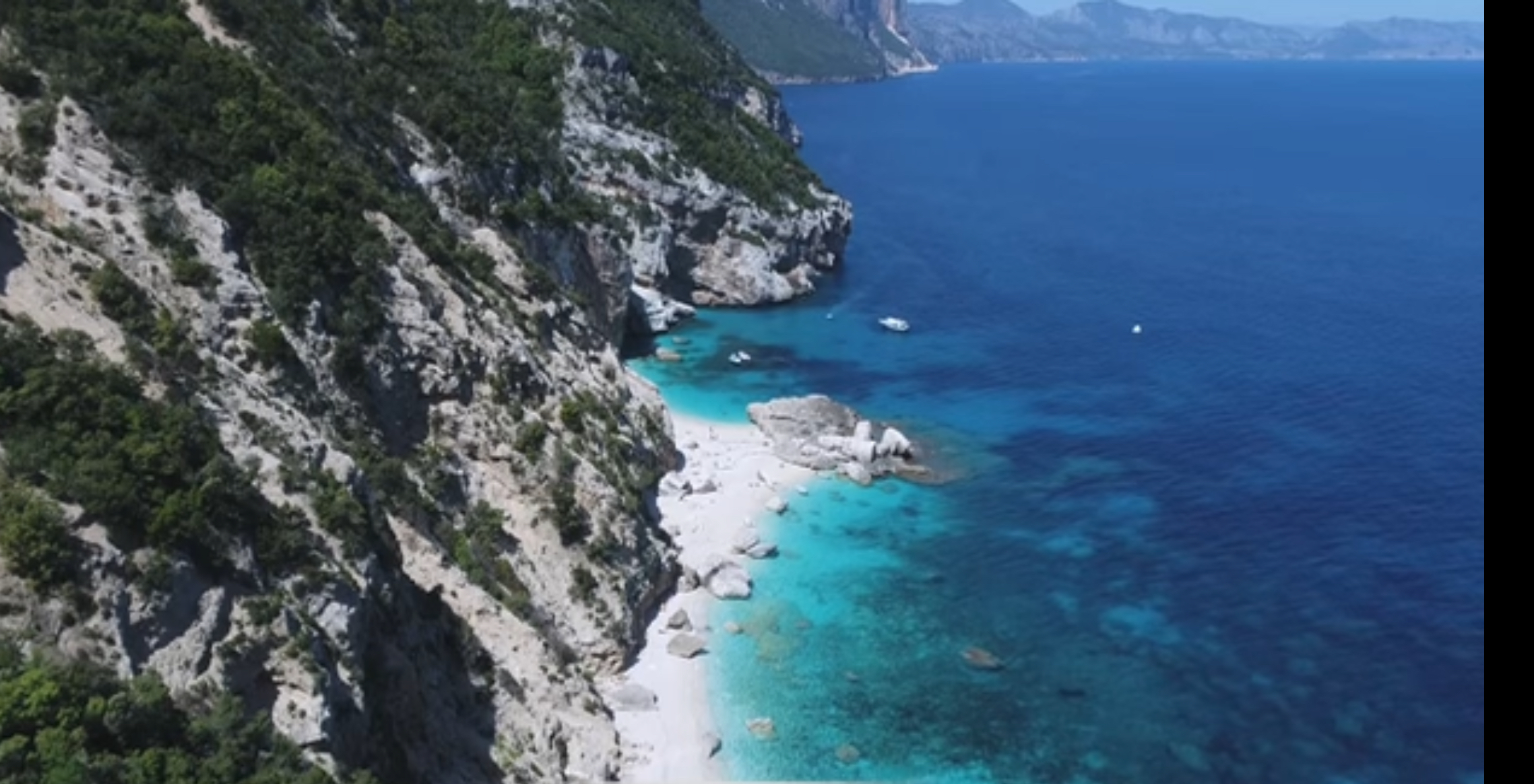
Cala Mariolu draws significant boat traffic in peak season, particularly across the late-morning window when excursions from multiple ports — Cala Gonone, Santa Maria Navarrese, and Arbatax — tend to converge here at once. Despite being harder to reach than Cala Luna, it can become heavily crowded during summer; being harder to reach doesn’t mean quiet. In July and August, expect a genuinely busy beach at midday. An early departure, or an operator whose itinerary reaches Cala Mariolu before the late-morning rush, is the most realistic way to see it with fewer people around.
Shade, Seasonal Facilities, and What’s Reliably Available
Cala Mariolu is a wild beach, not a developed one — don’t expect sunbed rentals, umbrella hire, or full-service facilities. A small seasonal refreshment point has operated here in some years, but its hours, offerings, and whether it operates at all vary by season and shouldn’t be relied upon. Shade is limited to what the surrounding cliffs and pine forest provide. Food service, toilets, and lifeguard presence should not be assumed either way — confirm current services before you go, or plan to arrive fully self-sufficient with your own water, food, and sun protection.
Suitability for Children, Older Travelers, and Limited Mobility
By boat, Cala Mariolu is a reasonable outing for families and older travelers. Boarding and disembarkation arrangements vary by vessel and operator, and may involve uneven or unstable surfaces. Travelers with mobility limitations should ask the operator for exact details before booking. There are no paved paths or accessible facilities at the beach. The land route is unsuitable for children, older travelers, or anyone without hiking experience — it shouldn’t be treated as a family-friendly alternative to the boat.
Water Shoes and What Else to Bring
- Water shoes: genuinely useful here, given the smooth but uneven pebble beach and rocky entry points.
- Water and snacks: don’t rely on any on-site facility being open.
- Sun protection: shade is limited, and boat decks offer little relief either.
- A dry bag for phones, cameras, or anything else you don’t want wet during boarding or swimming.
- Snorkel gear, if you have it — the water clarity here rewards it.
- Cash, useful for any seasonal kiosk and for landing fees your operator hasn’t already included.
Snorkeling Conditions and Boat-Traffic Awareness
The clarity of the water makes Cala Mariolu a genuinely good snorkeling spot, particularly near the rocks dividing the beach into two sections. That said, this is also a working cove with regular boat traffic arriving and departing all day. Follow any marked swimming areas and staff or crew instructions, and stay outside landing and navigation corridors at all times — this matters more here than simply keeping half an eye on nearby boats.
Does Cala Mariolu Deserve a Full Day?
For most visitors, Cala Mariolu works as one stop within a broader Gulf of Orosei excursion. The time ashore depends on the operator’s itinerary, assigned schedule, sea conditions, and current landing rules, so confirm the planned duration before booking. If you’ve hiked in independently, you’ll naturally spend more of your day here simply because of the effort required to arrive and leave, but that’s a function of the access method rather than the beach demanding a full day.
Cala Mariolu Compared with Cala Luna
Cala Luna, covered in our Cala Luna guide, is easier to reach by either boat or a moderate, marked hike from Cala Fuili. Access arrangements and capacity-management rules can change by season, so confirm the current system before visiting. Cala Mariolu is harder to reach by any method, meaning either a regulated boat landing or a genuinely demanding, expert-level hike, but that difficulty doesn’t translate to a quiet beach: Cala Mariolu can become heavily crowded in summer, since boats from three different ports converge here. If ease of access matters most, Cala Luna is more forgiving; if you want more strikingly colored water and don’t mind extra planning, Cala Mariolu is worth it — but don’t expect solitude at either.
Cala Mariolu Compared with Cala Goloritzè
Cala Goloritzè, covered in full in our Cala Goloritzè hiking guide, is the more restricted of the two: boats cannot land there at all, access is hike-only, and it requires its own reservation system with a marked, well-established trail. Cala Mariolu is the more boat-accessible of the two, with landing permitted under the sea-access system above, and its land route is officially documented, but it crosses considerably rougher, expert-level terrain than the marked path to Cala Goloritzè. If boat access matters, Cala Mariolu is the realistic choice; if you want the hike-only experience, Cala Goloritzè fits better.
Where to Stay for Visiting Cala Mariolu
Because Cala Mariolu has no road access, choosing accommodation is largely about choosing a convenient departure port. Two practical bases are Cala Gonone on the northern side of the Gulf of Orosei and Santa Maria Navarrese farther south along the Baunei coast.
Cala Gonone: A well-established base for Gulf of Orosei boat excursions, with accommodation, restaurants and access to other attractions such as Cala Luna and the Bue Marino caves. Staying within walking distance of the harbor can simplify early departures.
Santa Maria Navarrese: A smaller coastal base with a marina serving excursions along the Baunei coast. It is particularly convenient if your plans include Cala Mariolu, Cala Biriala and offshore views of Cala Goloritzè.
Compare Accommodation Near Cala Mariolu Departure Ports
Compare accommodation in either town, then check each property’s distance from the marina, parking arrangements and the departure point of your chosen boat operator before booking.
For a more detailed comparison of the region’s towns, accommodation locations and departure ports, see our East Coast & Ogliastra destination page.
Leave-No-Trace and Protected-Coast Behavior
Cala Mariolu sits within a stretch of coast under active environmental management, and the regulated landing system exists to protect it from the overuse that’s degraded less-managed beaches elsewhere. Pack out everything you bring in, including food waste — there are no guaranteed bins here. Don’t remove pebbles as souvenirs; their accumulation is part of what makes the cove worth protecting. Respect the pine forest above the beach and any posted signage, and keep noise and boat wake to a minimum near swimmers and the mooring area.
Who Should Choose This Beach — and Who Should Choose Another
Cala Mariolu suits travelers who want the Gulf of Orosei’s most vividly colored water and don’t mind the extra planning a regulated landing system requires. It’s a poor fit for anyone hoping for a casual, unplanned beach hike, since the land route here is genuinely unsuitable for that. If you want an easier hike-or-boat choice, Cala Luna is more forgiving; if you specifically want a hike-only, boat-free experience, Cala Goloritzè fits better. For the wider region, see our East Coast & Ogliastra destination page.