
Cala Biriala is one of the smaller regulated coves on the Baunei coast, tucked between Grotta del Fico and Cala Sisine and best known for a natural stone arch at water level. It sits under the same Costa di Baunei sea-landing system as Cala Mariolu, with its own lower capacity and its own landing rules. This guide covers current access, what to expect, and how it compares to nearby coves. For the wider region, see our Gulf of Orosei guide.
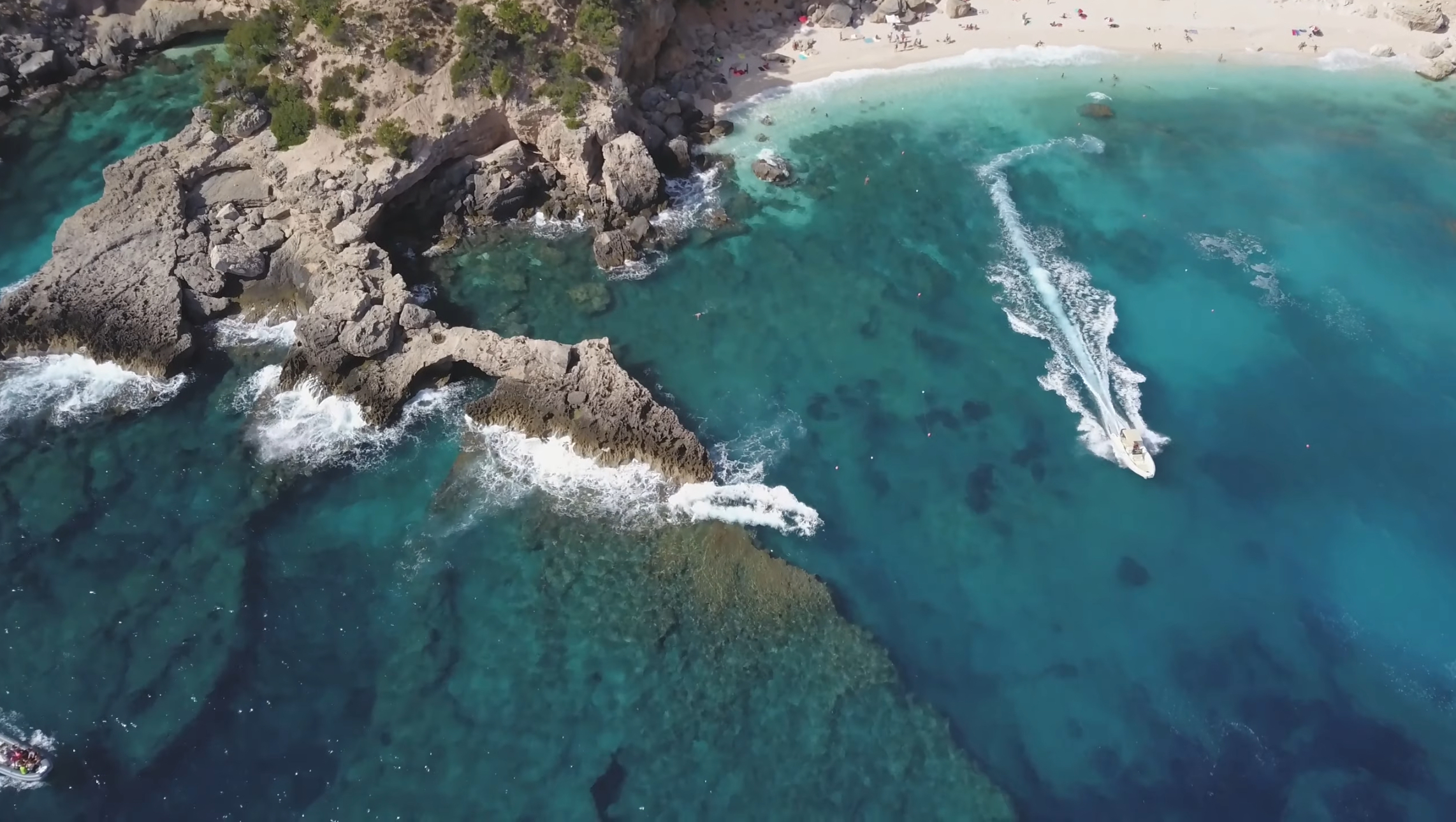
What Cala Biriala Is Like
Cala Biriala sits on the Baunei coast roughly halfway between Cala Goloritzè and Cala Luna, immediately south of Grotta del Fico and just before Cala Sisine. It’s a landslide-origin cove at the foot of limestone cliffs, with a beach made up of white pebbles and fine sand. To the south, a set of distinctive rock formations includes a natural arch at water level — one of the more photographed details on this stretch of coast. The water is turquoise and clear, and a promontory to the north carries the Biriala forest, from which the cove takes its current name.
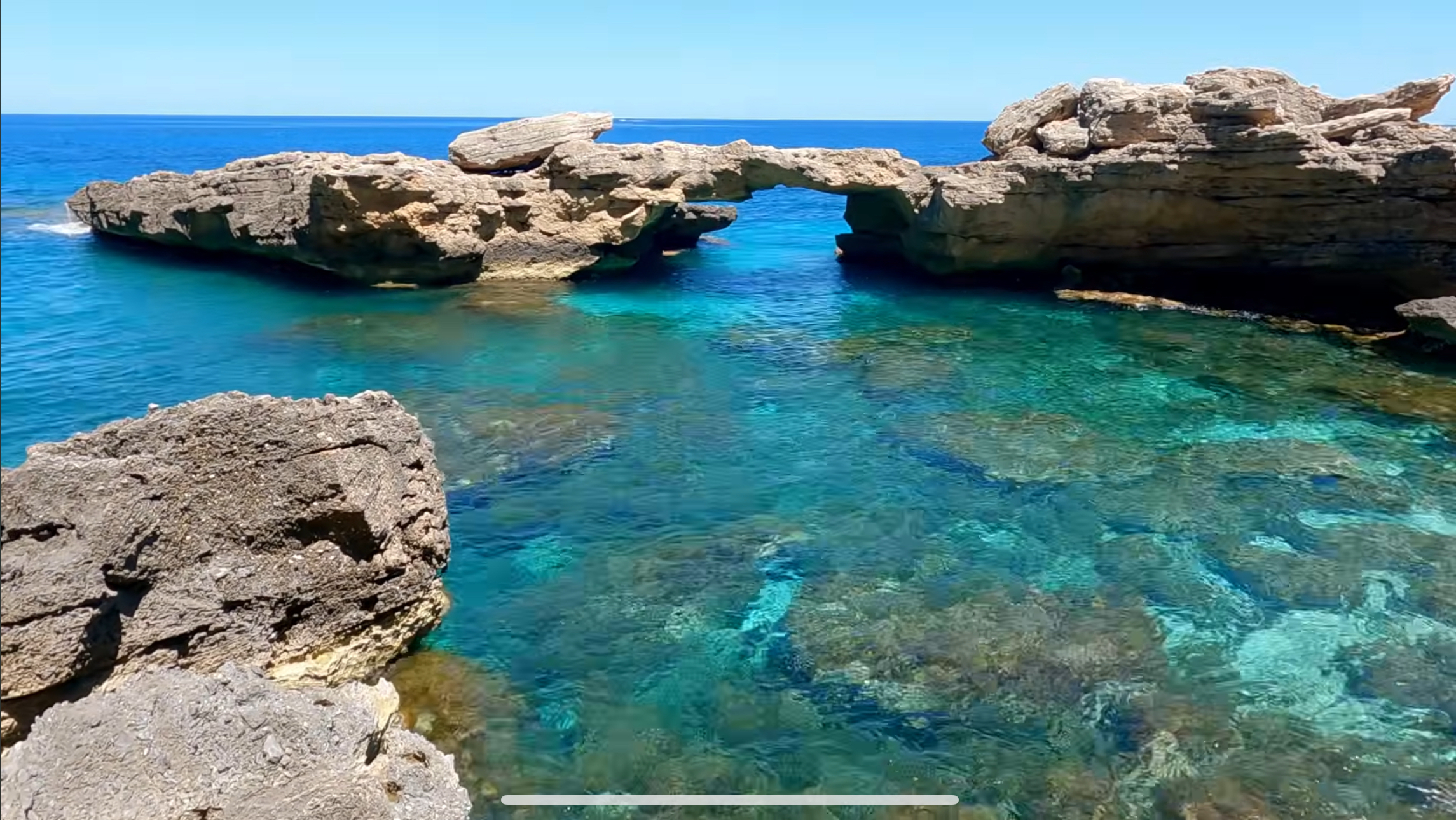
Location and the Name
Cala Biriala falls within the municipality of Baunei, part of the same regulated stretch of coast covered in our Cala Mariolu guide and Cala Sisine guide. Its original name was reportedly “Bilariccoro”; the current name comes from Tuscan fishermen and charcoal burners who worked this coast until around the 1960s. Traces of that era are still visible on the cliff north of the beach — old iron rungs and mooring rings once used to load charcoal onto boats, now heavily rusted and not something to rely on or climb.
Piscine di Venere Nearby
Just before Cala Biriala, heading south from Grotta del Fico, sits Piscine di Venere (“Venus’ Pools”) — a set of natural rock pools with water that shifts from turquoise to emerald green to deep blue. It’s commonly seen from the same boat excursions that visit Cala Biriala, though it’s a distinct stop rather than part of the beach itself.
Boat Access
Santa Maria Navarrese and Arbatax are established southern departure ports for this stretch of the Baunei coast. For details about the quieter of these two bases, see our Santa Maria Navarrese guide. Cala Biriala is commonly included on multi-stop excursions covering Cala Goloritzè’s coastline, Cala Mariolu, Grotta del Fico, and Cala Sisine. Scheduled motor-ship lines and smaller guided RIB excursions both serve this stretch of coast, with fares and specific itineraries varying by operator and season — confirm exactly which coves a given excursion includes, and how long the stop lasts, before booking.
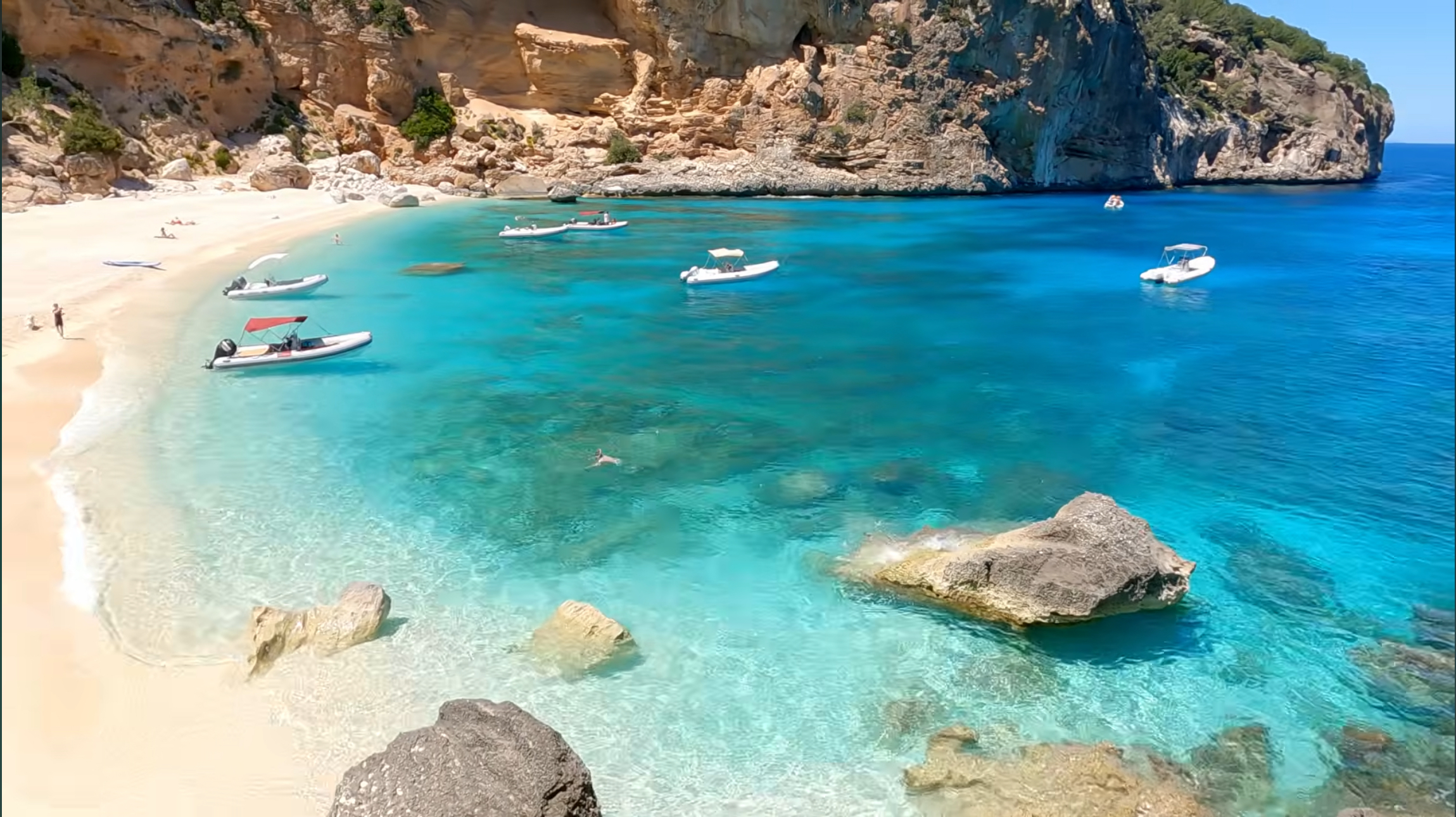
A Boat Tour That Includes Cala Biriala
One currently listed full-day dinghy tour departs from Santa Maria Navarrese and includes scheduled stops at Cala Biriala, Cala Mariolu, Piscine di Venere and Grotta del Fico, along with Cala Goloritzè. The itinerary and individual landings remain subject to weather and sea conditions, so review the current inclusions, additional cave charges and meeting instructions before booking.
Affiliate disclosure: The following is an affiliate link. If you book through it, SardiniaSardegna may earn a commission at no additional cost to you.
Current Sea-Landing Reservation System
Cala Biriala is included in the same Costa di Baunei sea-access system used for Cala Mariolu, Cala Sisine, and Cala dei Gabbiani, managed through the official Heart of Sardinia platform. For the 2026 season, this system lists a regulated period of May 1 through October 20, with a fee of €2 for landing at a single cove by sea or €3 for an itinerary covering multiple regulated Baunei coves in one day. This fee applies to sea arrivals only, not permitted land access. The current Heart of Sardinia listing gives Cala Biriala a capacity of 300 sea-landing places, notably lower than Cala Mariolu’s published capacity.
If you’re traveling with a ferry, an NCC service, or a skippered dinghy, ask the operator whether the booking or fee is already handled on your behalf — this varies and isn’t guaranteed across every operator. If you’re at the helm of a private or rental boat, use the official Costa di Baunei sea-landing booking page, select Cala Biriala, and enter any operator code supplied by your rental company.
Landing Times and Operational Rules
The current 2026 Heart of Sardinia booking page for Cala Biriala confirms the sea-landing capacity, regulated dates, and fees described above, but it does not publish a universal landing-duration limit on that page. Older figures for landing-time restrictions and vessel-size limits, including numbers tied to a 2021 ordinance, have circulated in older sources and shouldn’t be treated as current 2026 rules. Follow your booking confirmation, any beach-management instructions given on-site, and your operator’s current guidance rather than assuming a specific time limit in advance.
Weather and Sea Conditions
The Gulf of Orosei is exposed from the east, and wind from the northeast or east can make landing difficult or impossible for smaller craft, Cala Biriala included. When conditions don’t allow a safe landing, operators typically adjust the itinerary — an offshore view, a different sheltered stop, or a shortened visit — rather than guaranteeing a landing regardless of sea state.

Reaching Cala Biriala on Foot
A land route exists, starting from Località Ololbitzi on the Golgo plateau — the same general area covered in our Baunei and Golgo Plateau guide. According to official Baunei tourism information, the trail covers approximately 2.5 kilometers, with roughly 2 hours estimated for the descent and 2 hours 30 minutes for the return climb. Elevation change is reported at approximately +100 meters and −340 meters in the documented direction, and the route carries an EE (A) difficulty rating — a classification reserved for expert hikers, not a standard hiking-level trail.
This route has no trail signage, includes genuinely exposed sections, and involves ancient wooden ladders along with short climbing and down-climbing sections rather than a simple walking path. This is not an ordinary beach hike, and it isn’t suitable for inexperienced hikers attempting it independently. An expert local guide is recommended for anyone without direct, current experience on Baunei coast terrain of this difficulty.
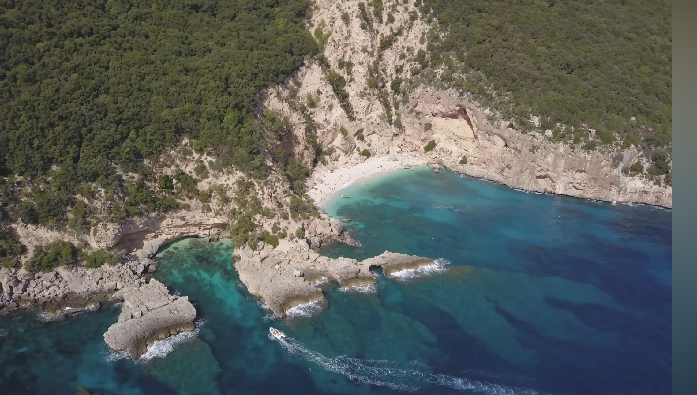
Facilities
Cala Biriala is an undeveloped, wild cove. Don’t assume that food service, drinking water, toilets, umbrella rentals, or other visitor facilities will be available. Bring your own water, food, and sun protection regardless of how you arrive.
Suitability for Families and Limited Mobility
By boat, family suitability here depends on the vessel, the landing procedure, and conditions on the day rather than any guaranteed calm — ask your operator directly if mobility or comfort with the boarding process is a concern. The land route is unsuitable for anyone without genuine expert-level hiking experience, regardless of age.
Snorkeling and Boat-Traffic Safety
The clear water and the rock formations around the natural arch make this a rewarding spot for snorkeling during your time ashore. As with any working cove in the gulf, stay aware of boat traffic, follow marked swimming areas and staff instructions, and stay outside landing and navigation corridors.
How Much Time to Allow
Without a confirmed universal 2026 landing-duration rule, time ashore at Cala Biriala depends on the operator and any current beach-management instructions given on the day. If a specific time limit matters to your plans, ask your operator or check the booking confirmation directly rather than assuming a fixed window.
Cala Biriala Compared with Cala Mariolu and Cala Sisine
Cala Mariolu, covered in our Cala Mariolu guide, is larger, better known, and carries a considerably higher sea-landing capacity (700 versus Cala Biriala’s 300). Cala Sisine, covered in our Cala Sisine guide, is larger still and has a higher capacity of its own, with a genuinely remote hiking approach. Cala Biriala has the lowest published sea-landing capacity of the three, but capacity alone does not establish how quiet it will feel on a particular day.
Responsible Tourism and Leave-No-Trace Behavior
Pack out everything you bring in, including food waste — bins aren’t guaranteed here. Don’t remove pebbles, sand, or shells as souvenirs. Follow any staff instructions and current beach-management guidance if arriving by boat, and treat the rusted historic ladder and mooring rings on the north cliff as a historical feature to look at, not a structure to use.
Who Should Choose Cala Biriala
Cala Biriala suits travelers already planning a boat day along the Baunei coast who want to add a smaller scenic stop alongside Cala Mariolu, Grotta del Fico, or Cala Sisine — its natural arch and clear water reward even a short visit. It is most commonly experienced as part of a multi-stop boat itinerary, while its expert-level land route is a separate undertaking. For the wider region this cove sits within, see our East Coast & Ogliastra destination page.