
Cala Sisine is one of the largest coves on the Baunei coast, reachable by boat under the same regulated sea-landing system as Cala Mariolu or overland through the Codula di Sisine gorge. The land approach requires careful transportation planning, particularly because the final road is suitable only for appropriate off-road vehicles. This guide covers what to expect and how to plan a visit. For the wider region, see our Gulf of Orosei guide and Baunei and Golgo Plateau guide.
What Cala Sisine Is Like
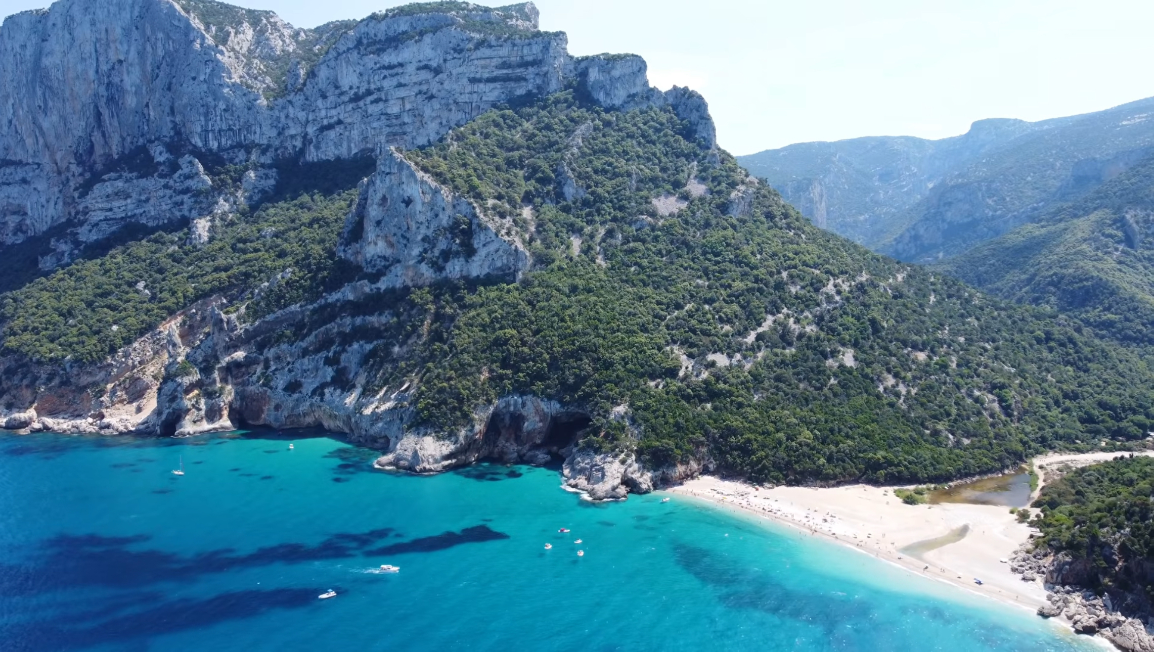
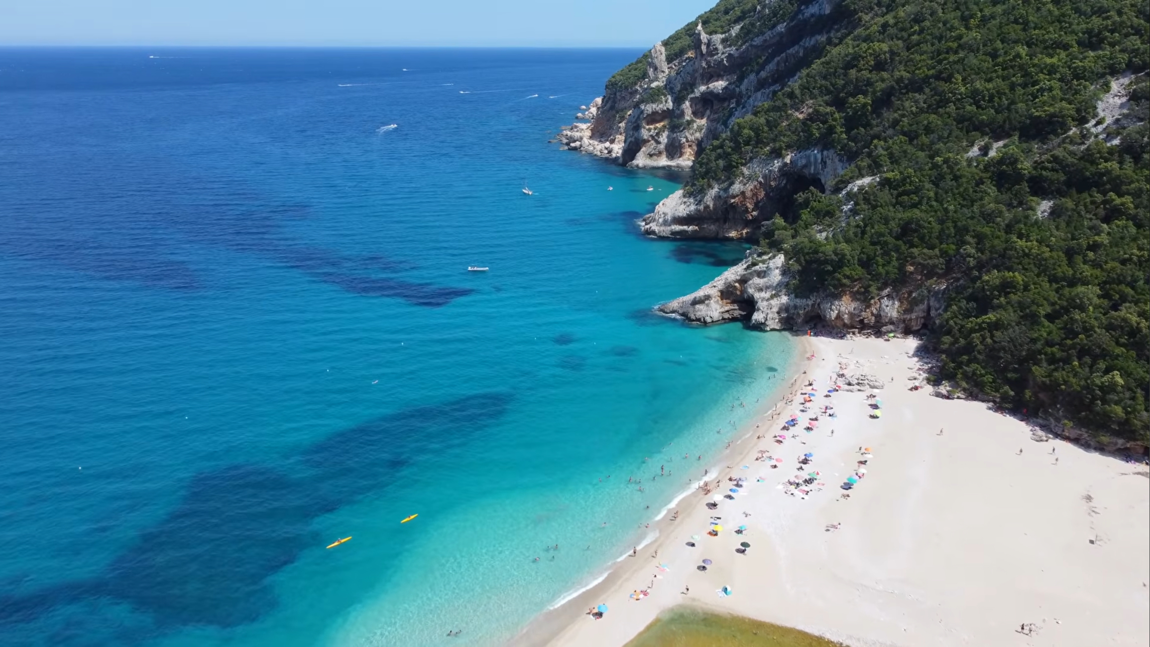
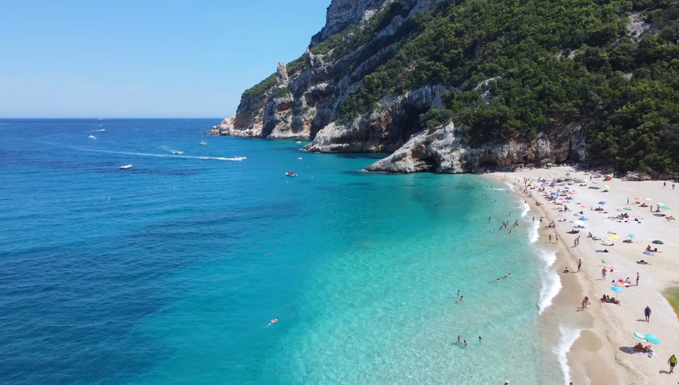
Cala Sisine sits on the Baunei coast between Cala Luna and Grotta del Fico, at the mouth of the Codula di Sisine gorge. According to the official Baunei tourism authority, the beach is more than 100 meters deep and roughly 500 meters long, making it notably larger than Cala Luna, Cala Mariolu, or Cala Goloritzè. Punta Plummare rises to one side, while the Serra Ovra cliffs form a dramatic limestone backdrop behind the beach.
It is also a relatively young beach. Historical maps from 1849 show Sisine as a deep inlet rather than the substantial beach seen today. The present shoreline largely formed from material carried down the Codula di Sisine during floods over the following century and a half, a process that can still continue after periods of heavy rain.
Beach Composition and Swimming Conditions
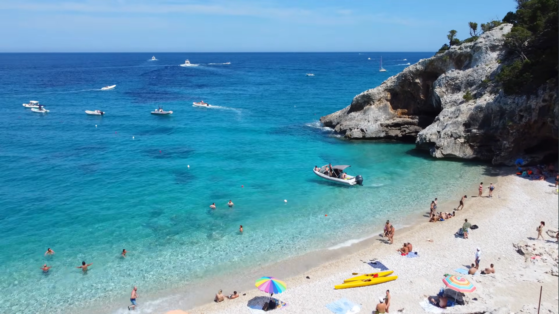
Cala Sisine has a pale pebble-and-shingle shoreline rather than fine sand. The light-colored seabed helps give the water its vivid turquoise appearance. Depth and swimming conditions vary along the shoreline and can change with wind and swell, so don’t assume a uniformly shallow or gentle entry simply because the cove looks sheltered.
The beach’s size can make it feel more spacious than the smaller coves nearby, but that doesn’t guarantee quiet conditions. Excursion schedules, private boats, weather, and the time of day all influence how busy it feels.
How to Get to Cala Sisine
There are two principal approaches: by boat under the regulated Costa di Baunei sea-access system, or overland from the Golgo plateau. Boat access is the more practical choice for most visitors. The land approach can be relatively short if you have access to a suitable off-road vehicle, but it becomes a long walking day if you’re traveling in an ordinary car.
Boat Access from Cala Gonone
Cala Gonone is a major northern departure point for excursions along the Gulf of Orosei. Cala Sisine sits farther from the port than Cala Luna and is generally visited as one stop on a longer excursion rather than as a standalone destination. Depending on the operator, an itinerary may combine it with Cala Luna, Cala Mariolu, a sea cave, or other coastal stops.
Schedules and itineraries vary by operator, season, demand, and sea conditions. Confirm that Cala Sisine is specifically included before booking rather than assuming every Gulf of Orosei excursion stops there. For more information about choosing a northern base, see our East Coast & Ogliastra destination page.
Boat Access from Santa Maria Navarrese and Arbatax
Santa Maria Navarrese and Arbatax are established southern departure ports for excursions along the Baunei coast. From this direction, Cala Sisine is usually part of a longer northbound itinerary that may include Cala Mariolu, Cala Biriala, Cala dei Gabbiani, or an offshore view of Cala Goloritzè. For more about the quieter of these two coastal bases, see our Santa Maria Navarrese guide.
A Boat Tour That Includes Cala Sisine
This full-day excursion from Santa Maria Navarrese specifically lists Cala Sisine and Cala Mariolu as its principal destinations. As with any boat trip on this coastline, stops and landing times can change with sea conditions, so review the current itinerary, inclusions, departure instructions, and cancellation terms before booking.
This section contains an affiliate link. If you book through it, SardiniaSardegna may earn a commission at no additional cost to you.
Scheduled Motorboats vs. Guided RIB Excursions
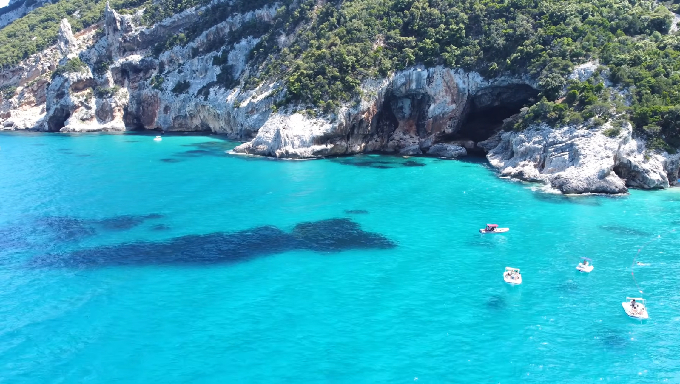
Larger scheduled motorboats generally operate fixed routes and carry more passengers. Smaller guided RIB excursions usually cost more but may provide a more flexible itinerary and a smaller-group experience. Inclusion of Cala Sisine varies with the operator and the day’s conditions, regardless of vessel type.
Ask how long the planned stop will be, whether passengers actually disembark, which other coves are included, and what happens if sea conditions prevent a safe landing. An itinerary shown online should be treated as the intended plan rather than an unconditional guarantee.
Private and Self-Driven Boat Access
Cala Sisine can also be reached using a private or rented boat, subject to the current sea-access rules. If you’re operating the boat yourself, navigation, weather judgment, safe anchoring or landing procedures, and the required reservation process become your responsibility. Follow the rental company’s operating area and instructions, and don’t exceed your boating experience simply because the coastline appears calm when you leave the harbor.
Current Sea-Landing Reservations
Cala Sisine is included in the Costa di Baunei sea-access booking system used for Cala Mariolu, Cala Biriala, and Cala dei Gabbiani. The system is managed through the official Heart of Sardinia platform.
For the 2026 season, the current official listing gives Cala Sisine a capacity of 1,800 sea-landing places during the regulated period from May 1 through October 20. The listed contribution is €2 per person for visiting one regulated cove by sea or €3 per person for an itinerary involving multiple regulated coves. These charges apply to sea arrivals rather than permitted land access.
If you’re traveling with a scheduled motorboat, NCC service, or skippered excursion, follow the operator’s instructions. The operator may handle some or all of the booking process, but don’t assume this without asking. If you’re operating a private or rental boat, use the official Costa di Baunei booking system and follow any instructions supplied by the rental company.
Capacity, fees, regulated dates, booking procedures, and landing conditions can change. Check the current official platform shortly before your visit rather than treating the 2026 figures above as permanent rules. We could not verify a fixed landing-duration limit specifically for Cala Sisine, so confirm any applicable time restriction when booking.
Weather and Sea Conditions
The Gulf of Orosei is exposed to weather arriving from the east. Northeasterly or easterly wind can make navigation and landing difficult, especially for smaller craft. Conditions may also change after an excursion has departed.
If a landing cannot be made safely, an operator may adjust the route, substitute another stop, provide an offshore view, or shorten the excursion. Treat itinerary changes as a normal possibility on this coastline rather than evidence that something has gone wrong.
Reaching Cala Sisine Overland
According to the official Baunei tourism authority, the overland route begins on the Golgo plateau. A dirt road branches off approximately 200 meters before the Church of San Pietro and follows the Codula di Sisine for about 13 kilometers toward Planu ‘e Murta.
From the clearing and parking area at Planu ‘e Murta, a marked path slightly longer than 1 kilometer continues to the beach. The official tourism description estimates approximately 30 minutes for this final walking section.
Road Conditions and the 4×4 Requirement
The transportation distinction matters. Official Baunei tourism guidance states that Planu ‘e Murta is accessible only with suitable off-road or 4×4 vehicles. Do not attempt the road in an ordinary rental car, and always follow your rental company’s restrictions concerning unpaved roads.
Visitors using an ordinary car are directed to stop near Ololbissi, leaving approximately 8 kilometers to reach the beach on foot. Confirm whether that distance describes the complete remaining approach under current conditions and identify exactly where parking is permitted before setting out. An 8-kilometer approach, followed by the return journey, turns the visit into a substantial walking day.
Road surfaces can deteriorate after rain or maintenance interruptions. Even a suitable vehicle doesn’t make current access automatic. Check locally before departure and consider an organized off-road transfer if one is available and you aren’t experienced driving on rough, remote tracks.
Walking Conditions and Preparation
We could not confirm a current official difficulty rating or precise elevation figure for the complete approach. The effort required depends heavily on where you begin walking: from Planu ‘e Murta, the final path is comparatively short; from the ordinary-car stopping area near Ololbissi, the walking distance is much greater.
Because this is a remote approach, download an offline map or GPS track and confirm current road and route conditions locally. Carry ample water for the distance, temperature, and return journey; there is no reliable drinking-water source along the route or at the beach. Wear sturdy, closed-toe footwear with reliable grip, and bring adequate sun protection.
Don’t calculate the day using only the outward walk. Allow enough time, water, and energy for the complete return journey, and avoid committing to an unfamiliar remote route late in the day.
Can You Hike In and Return by Boat?
A boat return should never be assumed. We could not confirm a regular, dedicated Cala Sisine service designed specifically to collect hikers. Boats visiting the cove may be operating full scheduled excursions and might not have capacity or authorization to accept additional passengers.
If you want to walk in and return by sea, arrange the journey directly with a specific operator before leaving. Confirm the departure time, destination port, price, reservation requirements, and what happens if weather prevents the boat from landing. Without a confirmed arrangement, plan to return overland by the same route.
Facilities at Cala Sisine
A tavern known as Su Coile has operated near the beach in previous years, housed in a structure inspired by a traditional Baunese shepherd’s hut. Historical accounts also mention a campsite in the nearby woods that was destroyed by flooding decades ago.
Do not build your plans around seasonal service being available. Confirm locally whether any food or drink facility is currently operating. Arrive prepared with your own water, food, and sun protection, and don’t assume toilets, drinking water, waste bins, beach equipment, or lifeguards will be available.
Families, Older Travelers, and Limited Mobility
Arriving by boat can make Cala Sisine a workable family outing, but boarding and disembarkation arrangements vary considerably between vessels. Landing may involve a gangway, steps, moving surfaces, pebbles, or entering shallow water. Ask the operator for specific accessibility information if anyone in your group has limited mobility.
The long overland option from the ordinary-car stopping area is not a casual family walk. Its suitability depends on fitness, heat, current route conditions, and the experience of everyone in the group. The shorter path from Planu ‘e Murta is more manageable, but reaching that point requires appropriate transportation.
Swimming, Snorkeling, and Boat-Traffic Safety
The clear water and pale seabed can make Cala Sisine appealing for swimming and snorkeling. Visibility and conditions vary, however, and lifeguard coverage should not be assumed.
Remain alert to boats arriving and departing, follow any marked swimming areas and staff instructions, and stay outside landing and navigation corridors. Children and less confident swimmers need active supervision even when the water appears calm.
Crowds and the Best Arrival Strategy
Cala Sisine’s larger shoreline may feel more spacious than Cala Mariolu or Cala Goloritzè, but crowd levels vary by date, time, weather, and excursion schedules. The regulated capacity manages sea access; it doesn’t promise a quiet beach.
An early departure can help you avoid the busiest part of the day and, when walking, reduce exposure to the strongest heat. Boat passengers remain tied to their operator’s schedule, so ask about the expected arrival time and duration ashore before booking.
How Long to Spend at Cala Sisine
By boat, Cala Sisine is normally one stop within a broader coastal excursion. Your time at the beach depends on the operator’s itinerary, current access arrangements, and sea conditions.
Overland visitors should treat the outing as a full-day commitment unless they have confirmed 4×4 access to Planu ‘e Murta and understand the remaining route. Anyone walking from near Ololbissi must account for the substantial approach, the return distance, rest stops, and time spent at the beach.
Cala Sisine Compared with Cala Luna
Cala Luna is easier to reach from Cala Gonone, either by a direct seasonal boat service or by the established trail from Cala Fuili. Cala Sisine is larger, but its independent land approach requires more transportation planning. If straightforward access matters most, Cala Luna is the more forgiving choice.
Cala Sisine Compared with Cala Mariolu
Cala Mariolu is a much smaller cove with a lower sea-landing capacity and a demanding expert-level land route. Cala Sisine has a considerably larger shoreline and a different overland-access problem: the final road to its short walking approach requires a suitable off-road vehicle. Both beaches participate in the Costa di Baunei sea-access system.
Cala Sisine Compared with Cala Goloritzè
Cala Goloritzè prohibits boat landings and uses a reservation-based hiking system from Su Porteddu. Cala Sisine permits regulated sea landings and has no equivalent beach-hiking permit described here. Its overland logistics instead depend on vehicle suitability, the condition of the dirt road, and where you begin walking.
Responsible Tourism
Pack out everything you bring, including food waste, and don’t remove pebbles, shells, plants, or rocks. Follow the designated route when approaching overland, both to reduce erosion and to avoid unnecessary risk in remote terrain.
If arriving by sea, respect the current reservation process, landing arrangements, swimming zones, and instructions from operators or on-site staff. Cala Sisine’s size does not make it less environmentally sensitive than the smaller coves nearby.
Who Should Choose Cala Sisine
Cala Sisine suits travelers who want to experience one of the Baunei coast’s largest beaches and are comfortable planning around regulated boat access or complicated overland logistics. It is less suitable for anyone expecting a developed beach, guaranteed facilities, or a short drive in an ordinary rental car.
If ease of access matters most, Cala Luna is generally the more flexible choice. Travelers wanting a dramatic Baunei cove reached principally by regulated boat landing may prefer Cala Mariolu, while experienced visitors specifically seeking a reserved hike may prefer Cala Goloritzè. For broader planning, return to our Gulf of Orosei guide.